Original article by Dr. Mariette van den Berg, published in the Horses and People Magazine (November 2016). Cover photo by Linda Zupanc.
When it comes to horse property layout, it pays to consider the permaculture design approach because it aims to build systems that are easier to manage, more efficient and sustainable, whilst considering the health and wellbeing of all – people, horses, plants and the soil that sustains them.
Following on from last month’s look at how the shape of the land influences design and layout of a property, in this Part 6 of this exclusive Equine Permaculture Design Series, Mariette van den Berg gives some practical solutions for managing water run-off and controlling erosion – one of the major problems on horse properties.
When we design the layout of our horse properties, we cannot ignore the importance of the shape of the land. Especially when we are dealing with uneven ground, with, slopes, hills and valleys, further design considerations need to be taken into account because the contour of the land has a pronounced effect on the flow of energy in our system!! If you are managing horses on a hilly property, you for sure have experienced the effect of this on water flow, soil condition and grass cover. Erosion and run-off is one of the major problems on horse properties. While soil erosion may be more obvious on hillier or smaller properties with higher stocking density, flatter and larger properties are not exempted.
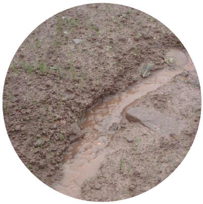 Soil erosion is a naturally occurring process that affects all landforms. In agriculture, soil erosion refers to the wearing away of a field’s topsoil by the natural physical forces of water and wind or through forces associated with farming activities such as tillage and animal grazing. Erosion, whether it is by water, wind, tillage or animal grazing, involves three distinct actions – soil detachment, movement and deposition. Topsoil, which is high in organic matter, fertility and soil life, is relocated elsewhere “on-site” where it builds up over time or is carried “off-site” where it fills in creeks, rivers or drainage channels. Soil erosion reduces cropland productivity and contributes to the pollution of adjacent watercourses, rivers, wetlands and lakes.
Soil erosion can be a slow process that continues relatively unnoticed or can occur at an alarming rate, causing serious loss of topsoil. Soil compaction, low organic matter, loss of soil structure, poor internal drainage, salinisation and soil acidity problems are other serious soil degradation conditions that can accelerate the soil erosion process. In the case of horse properties that deal with large grazing animals, compaction is typically the main cause of soil erosion and soil degradation.
In the previous edition we already briefly describe how the shape of the land (i.e. slope) affects natural energies such as water, materials, heat, erosion control, fire control and aspect. In this article we would like to focus primarily on erosion control and how we can manage run-off, specifically we will be discussing 8 ways to prevent/manage erosion on horse properties.
1. Understanding contours and shape of the land.
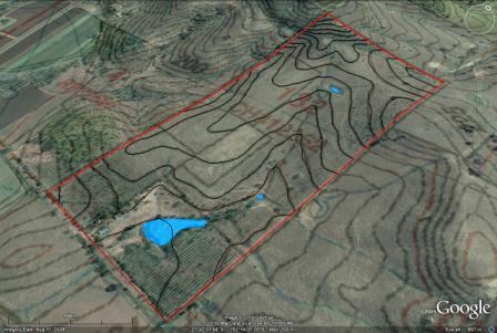
If you want to work with natural patterns and prevent erosion you must familiarise yourself with a contour map of your property. A contour map is illustrated with contour lines, which shows valleys and hills, and the steepness of slopes. The contour interval of a contour map is the difference in elevation between successive contour lines. From these contours, a sense of the general terrain and slope can be determined. The steeper and longer the slope of a field, the higher the risk for erosion.
 Soil erosion by water increases as the slope length increases due to the greater accumulation of runoff. Consolidation of small fields into larger ones often results in longer slope lengths with increased erosion potential, due to increased velocity of water, which permits a greater degree of scouring (carrying capacity for sediment). Therefore its essential that if you are dealing with a hilly property and/or lot of water run-off that you work as much as possible on contour lines and integrate methods such as keyline design (ploughing), swale design and on contour vegetation planting/mulching and fencing to prevent erosion.
2. Contour ploughing and Keyline planning (ploughing)
Contour ploughing or contour farming is the farming practice of ploughing and/or planting across a slope following its elevation contour lines. These contour lines create a water break which reduces the formation of rills and gullies during times of heavy water run-off; which is a major cause of top soil loss and soil erosion. The water break also allows more time for the water to settle into the soil. In contour ploughing, the ruts made by the plough run perpendicular rather than parallel to slopes, generally resulting in furrows that curve around the land and are level. This method is also known for preventing tillage erosion. Tillage erosion is the soil movement and erosion caused by tilling a given plot of land.
A similar practice is contour bunding where stones are placed around the contours of slopes. Soil erosion prevention practices such as this can drastically decrease negative affects associated with soil erosion such as reduced crop productivity, worsened water quality, lower effective reservoir water levels, flooding, and habitat destruction. Contour farming is considered an active form of sustainable agriculture.
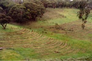
Fig 1. shows keyline ploughing on a hillside. Notice the plough lines on the ridge fall and rise in the valley. Movement of water is then slowly directed to the dry ridges. Compaction layers are shattered and the 3 life forces, air, light and water are allowed to penetrate the ground and kickstart life back into the earth.
Keyline planning/ploughing works slightly differently from contour ploughing. The Keyline design and plough concept was originally developed by P.A. Yeomans in the 1950s to address issues of dwindling water supplies and soil erosion on Australian rangeland. Yeoman developed a system of ‘amplified contour ripping’ that maximises productive use of rainfall and facilitates the uniform irrigation of land.
The name Keyline was given to the particular contour that runs through the Keypoint, in all small headwater valleys where the slope change occurs. This contour is the primary contour in Keyline planning. The Keypoint is the found at the break of a slope where the land goes for convex to concave. Keypoints are often characterized by the beginning of a discernable channel, where subsurface flow from higher in the slope surfaces — in effect, like the end of a pipe — and can be captured and redistributed. This is also the best place for farm dams. It’s the point of deposition and this is where all clay forms (we also addressed this in our previous article). Identifying the Keypoint, and attendant Keyline, is the starting point for Keyline design. A Keyline is the contour line that intersects with the Keypoint. As opposed to contour lines, which often vary in distance along their length, Keylines fall off contour at the same elevation along the length of the line such that Keylines always run parallel to one other, making the creation of Keyline cuts particularly amenable to mechanical management using a tractor and (P.A. Yeomans) plough.
The main idea behind Keyline design is to capture water at the highest possible elevation and comb it outward toward the (often drier) ridges using gravitational forces, reversing the natural concentration of water in valleys. The result of Keyline cultivation is an overall drift of surface run-off water, which prevents run-off concentration and the resultant gully erosion. It increases the time of contact between the rain and the earth and has the effect of turning storms into steady soaking rain. Rain may have become less frequent in some parts of Australia, but its intensity and volume over a twenty-four-hour period is growing.
3. Swales/ contour banks
Water flows the fastest straight down a slope, and the effects of erosion will be most pronounced when water has the most direct path down a slope. Additionally, when water flows fast down a slope, very little of it is absorbed into the soil. By digging trenches on contours of the slope (swales), the flow of water can be slowed down, and diverted sideways on its downhill journey, to allow it to soak into the soil. Swales are not the same as contour banks. Contour banks actually redirect the water slightly off contour and drain to a central point to slow water and to stop erosion. Swales are level banks that follow contour from start to finish. Swales as used in permaculture are designed to slow and capture run-off by spreading it horizontally across the landscape (along an elevation contour line), facilitating run-off infiltration into the soil (figure 2).
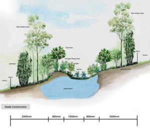
Figure 2: Swales with inclusion of trees (MB Equine Services).
A swale is created by digging a ditch on contour and piling the dirt on the downhill side of the ditch to create a berm. The soil that is excavated from the ground is placed, uncompacted, on the lower side of the excavation in a rounded mound shape. Once the topsoil on the pasture is at 100% water-holding capacity, surface run-off flows into the swale. The water is absorbed and taken deep underground to recharge the subsoil and replenish underground springs. This process slows water in the landscape and retains it in the ground for longer periods of time.
4. On contour fencing
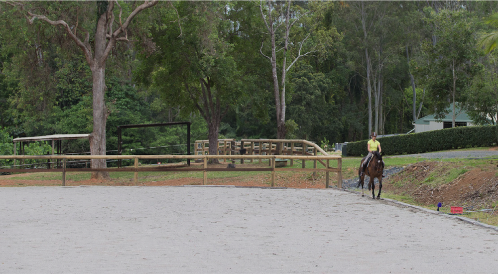
Likewise, when constructing paths, tracks, laneways (for example for paddock paradise set ups) and fences, it is best to have these run along the contours of the site, and not downhill, as downhill running paths will create significant soil erosion, because there are no ground cover plants protecting the soil on a cleared path. Fences holding horses will become tracks as horses walk the fence-line day after day, so we also avoid running these straight downhill if possible.
5. Vegetation/ Planting
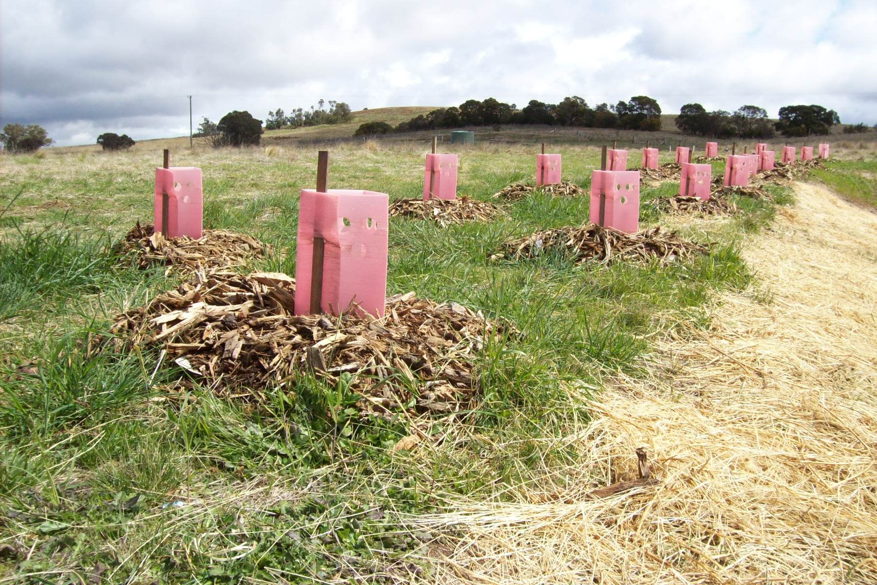 The simplest and most natural way to prevent erosion is through planting vegetation. Plants establish root systems, which stabilises soil and prevents soil erosion.Having vegetation such as shrubs and trees will help control soil erosion and a forested steep slopes also warms the cool night air to create a thermal belt as described in our previous article. When water runs downhill, it will carve its own watercourses and gullies, washing away the soil in the process. Trees, vegetation and ground covers absorb the flow of the water, and by creating a buffer between the flowing water and the soil, they control the problem of soil erosion. That is why it’s also important to think in terms of ground/ grass cover for your pasture areas. Healthy topsoil and good grass cover will act like a sponge, soaking up the water (and reducing direct and fast run-off).
6. Mulching (and slashing)
Many materials are used as mulches, which are used to retain soil moisture, regulate soil temperature, build soil, suppress weed growth, and for aesthetics. They are applied to the soil surface, around trees, paths, flowerbeds, to prevent soil erosion on slopes, and in production areas for flower, vegetable crops or pastures. When applied correctly mulches can dramatically improve soil productivity. Mulch layers are normally two inches or more deep when applied. A mulch is usually but not exclusively organic in nature. It may be permanent (e.g. plastic sheeting) or temporary (e.g. straw, bark chips). Mulches together with manure or compost improves the activity of worms and other organisms, which are important for building soil and increasing nutrient availability. Mulch is applied at various times of the year depending on the purpose. Towards the beginning of the growing season mulches serve initially to warm the soil by helping it retain heat which is lost during the night.
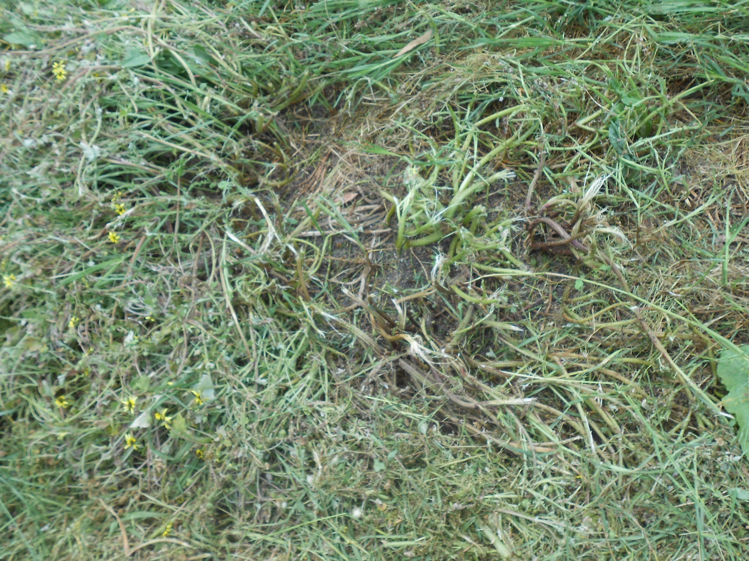 On horse properties you could mulch your pastures by slashing long-standing weeds and old bunch grasses. This allows early seeding and transplanting of certain crops, and encourages faster growth. As the season progresses, mulch stabilises the soil temperature and moisture, and prevents the growing of weeds from seeds. In temperate climates the effect of mulch is dependent upon the time of year they are applied and when applied in fall and winter, are used to delay the growth of perennial plants in the spring or prevent growth in winter during warm spells, which limits freeze thaw damage.
7. Geotextile and geocells
Using geotextiles is an effective method because it also stabilises soil. When used in conjunction with growing vegetation, it is even more effective. Geotextiles are filter fabrics that are used to stabilise loose soil and increase stability from wind and water erosion. Made from synthetic and natural fibres, geotextiles help in the filtering, separation, and drainage of water from the soil. Geotextiles can be woven, non-woven, or knitted. All these different fabric compositions are suitable and can be used in various applications.
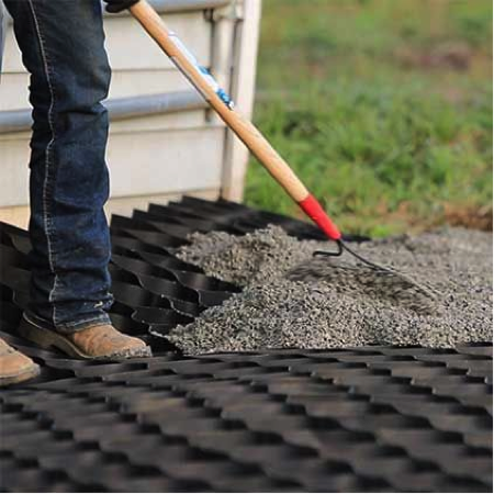 Geotextiles are mainly used in civil engineering, agricultural and erosion control applications. It has been proven to stabilise locations such as roads, railroads, canals, construction sites, coastal engineering, and dams. Another variant of the textile concept is the geocells/ matting, which is a three-dimensional mat or tile made from polyethylene grids (cells or honey-combs). The structure retains a layer of top soil and anchors the growing grass roots thus providing a stable surface highly resistant the forces of rain drops and run off. Other materials such as pea-rock and sand can also be used to fill the cells.
The cellular design allows for custom sizes, configuration and adaptability to a variety of terrains. The hydraulic properties are influenced by the type and compaction of the fill material. Geocell/matting has many applications; slope protection, horse sacrifice areas, tracks, roads, livestock/horses water points, ditches, ponds/dam walls etc.
8. Retaining Walls (and Terracing)
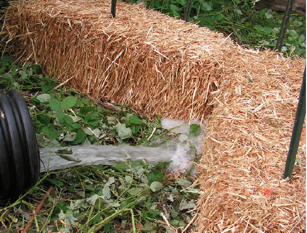 Retaining walls can be built around the area of erosion to prevent water run off. Runoff water leads to further erosion, and if used with other methods (terracing), retaining walls can be a very effective way to prevent soil erosion. Retaining walls such as Rock (or Straw) gabions can be very useful. Rock gabions are baskets made from flexible steel wire mesh and filled with granite or basalt rock.
Rock gabions are constructed in various sizes and are commonly used for along creek banks, over soft ground, steep slopes and rock fall areas to trap sediment. The purpose of rock gabions is to prevent undercutting and/or scouring at the base of steep slopes. Vegetation may be incorporated into the gabion by placing cuttings between the gabion layers. The cuttings will take root in the gabions and the soil behind the structure. The vegetation provides additional stability once the root structure has developed.
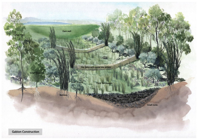
Fig. 3 Gabion example (MB Equine Services)
Summary
These solutions to control water run-off can be used in combination to prevent and manage soil erosion in different areas on your horse property.
The structures and materials you choose to use will largely depend on the shape of your land, your budget and property design ideas. The most important aspect of erosion control is understanding land contours, and the effect slope has on water and animal traffic, and learning to work with them to reduce damage to your land.
For example, if you are planning on fencing areas for your horses’ pastures or planting trees/shrubs, use contours for placement. This small adaption won’t cost you necessarily more (maybe you have to run a few extra meters), but in the long run, it will avoid damage and loss of soil and, consequently, grasscover, which will always cost much more in labour and money to restore!
Companion articles of this EP series can be found on the H&P website: https://www.horsesandpeople.com.au/

Comment(1)
Melissa says:
November 30, 2016 at 5:11 amThanks for posting this! Very useful tips 🙂 Currently working on constructing swales!